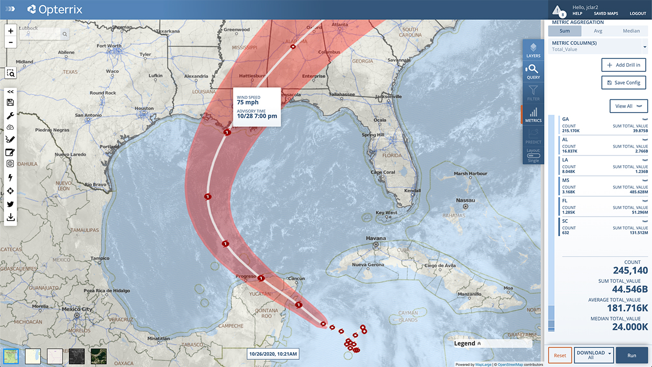
Tropical Storm Zeta is heading for the Yucatan Peninsula. It is currently located about 140 miles southeast of Cozumel, moving northwest at 10 MPH. The storm is expected to move over the Yucatan Peninsula overnight tonight.
The current National Hurricane Center forecast has Zeta only reaching Category 1 status during its time in the Gulf as it moves towards the U.S. Current landfall projections have the storm hitting southern LA and tracking very near New Orleans sometime late Wednesday night. The good news is that Zeta is expected to be moving fairly quickly as it is forecast to be near the Atlantic coast by early Friday morning.
The NHC expects cooler water temperatures in the northern Gulf and increasing shear to inhibit strengthening. However, there is a chance for significant intensification as Zeta reaches the Central Gulf Coast. It is something we will need to keep an eye on tomorrow after Zeta moves away from Mexico.
Opterrix provides insurers with the most advanced hurricane prediction, monitoring, alerting technology in the risk industry. Learn more at Opterrix.com.